File:LA2-South-America-UTM-zones.png
Jump to navigation
Jump to search
Size of this preview: 477 × 600 pixels. Other resolutions: 191 × 240 pixels | 382 × 480 pixels | 891 × 1,120 pixels.


Original file (891 × 1,120 pixels, file size: 199 KB, MIME type: image/png)

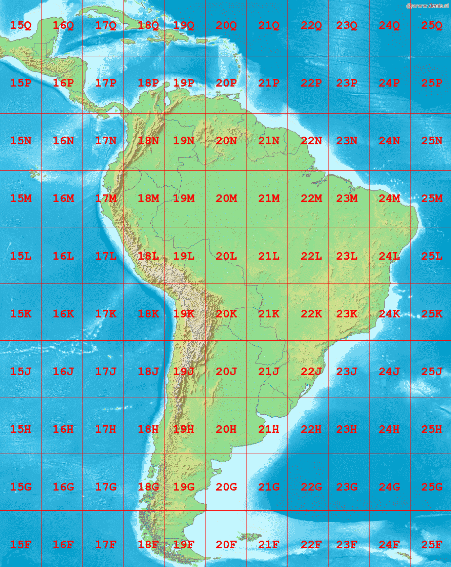
Map of South America, showing the latitude and longitude zones of the en:Universal Transverse Mercator coordinate system, from 15F to 25Q.
Bounding box West -96°, South -56°, East -30°, North 24°. Center at 16°00′00″S 63°00′00″W / 16.00000°S 63.00000°W.


|
This image is in the public domain because it came from the site https://www.demis.nl/products/web-map-server/examples/ and was released by the copyright holder. Permission is granted to copy, distribute and/or modify this map since it is based on free of copyright images from: www.demis.nl. See also approval email on de.wp and its clarification.
|

|
|
This work has been released into the public domain by its copyright holder, www.demis.nl. This applies worldwide. In some countries this may not be legally possible; if so: www.demis.nl grants anyone the right to use this work for any purpose, without any conditions, unless such conditions are required by law.
|
File history
Click on a date/time to view the file as it appeared at that time.
| Date/Time | Thumbnail | Dimensions | User | Comment | |
|---|---|---|---|---|---|
| current | 05:09, 3 September 2006 | | 891 × 1,120 (199 KB) | wikimediacommons>LA2 | Map of South America, showing the latitude and longitude zones of the en:Universal Transverse Mercator coordinate system, from 15F to 25Q. Bounding box West -96°, South -56°, East -30°, North 24°. Center at {{coor d|16.00000|S|63.00000|W|scale:4 |
File usage
There are no pages that use this file.
