File:Potamopyrgus antipodarum map.png
Jump to navigation
Jump to search
No higher resolution available.
Potamopyrgus_antipodarum_map.png (600 × 402 pixels, file size: 14 KB, MIME type: image/png)
| Description |
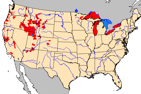
English: Distribution map of Potamopyrgus antipodarum in the USA in 2009. |
| Date | |
| Source | Downloaded from http://nas2.er.usgs.gov/arcims/interactive/interactive.asp?SpeciesID=1008 and a bit cropped. |
| Author | United States Geological Survey |
This image is in the public domain in the United States because it only contains materials that originally came from the United States Geological Survey, an agency of the United States Department of the Interior. For more information, see the official USGS copyright policy.
|
File history
Click on a date/time to view the file as it appeared at that time.
| Date/Time | Thumbnail | Dimensions | User | Comment | |
|---|---|---|---|---|---|
| current | 20:21, 5 July 2009 | | 600 × 402 (14 KB) | wikimediacommons>Snek01 | {{Information |Description={{en|Distribution map of ''Potamopyrgus antipodarum'' in the USA in 2009.}} |Source=Downloaded from http://nas2.er.usgs.gov/arcims/interactive/interactive.asp?SpeciesID=1008 and a bit cropped. |Date=2009-07-05 |Author=United Sta |
File usage
There are no pages that use this file.