File:Twin Cities Zephyr Oregon Illinois early 1940s.jpg
Summary
| Description |
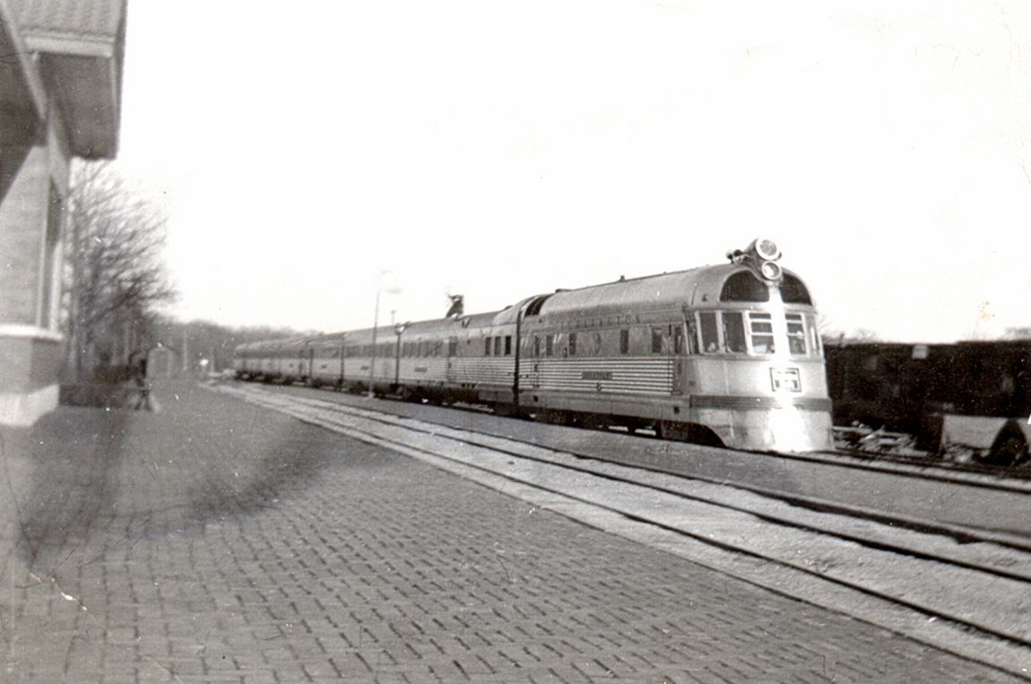
The Burlington Zephyr in the early 1940s. This is the Twin Cities Zephyr, which ran between Chicago and Minneapolis-St. Paul. This was the second route on which the Burlington Route (or CB&Q) used the Zephyr. There were two trains in each direction every day, the Morning Zephyr and the Afternoon Zephyr. The Zephyr was a new concept in passenger trains, with stainless steel cars by Budd Co. and a diesel engine by General Motors. It had a fixed trainset with a set of wheels joining each pair of cars, rather than each car having two sets of wheels. All of this made the train lighter, and potentially gave higher speed. The first Zephyr in 1934 was the Pioneer Zephyr. a three-car trainset. The Twin Cities Zephyr began with a similar trainset in 1935, but this longer set replaced it in 1936. This trainset stayed in service until 1947. At one time, the Twin Cities Zephyr was the fastest train in the world. It traveled 427 miles (687 km) between Chicago and St. Paul in six hours, for an average speed (including stops) of 71 mph (114 kph). The highest speed was on the segment between Prairie du Chien and East Dubuque, Illinois, 84 mph (135 kph). When my family went from Rockford to Prairie du Chien, we went to Oregon by bus, where we caught the Zephyr. Oregon is about 25 miles (40 km) southwest of Rockford. The train trip was about two hours. It appears that my father took this photo at the Oregon station. Light and shadows suggest that this is the Afternoon Zephyr. Zephyr is not a common word. It means a breeze from the west. |
| Date | circa |
| Source |
Oregon, Illinois - Twin Cities Zephyr (early 1940s)
|
| Author | Roger Wollstadt from Sarasota, Florida |


| Camera location |  | View this and other nearby images on: OpenStreetMap |  |
|---|

Licensing


- You are free:
- to share – to copy, distribute and transmit the work
- to remix – to adapt the work
- Under the following conditions:
- attribution – You must give appropriate credit, provide a link to the license, and indicate if changes were made. You may do so in any reasonable manner, but not in any way that suggests the licensor endorses you or your use.
- share alike – If you remix, transform, or build upon the material, you must distribute your contributions under the same or compatible license as the original.

|
This image, originally posted to Flickr, was reviewed on 29 March 2012 by the administrator or reviewer File Upload Bot (Magnus Manske), who confirmed that it was available on Flickr under the stated license on that date. | 
|
File history
Click on a date/time to view the file as it appeared at that time.
| Date/Time | Thumbnail | Dimensions | User | Comment | |
|---|---|---|---|---|---|
| current | 03:11, 29 March 2012 | | 1,150 × 763 (239 KB) | wikimediacommons>File Upload Bot (Magnus Manske) | Transferred from Flickr by User:We hope using flickr2commons |
File usage
There are no pages that use this file.
